
Since the topic of the Crown is very much in focus in Auroville these days, we thought we’d explore the origins of the Crown as an urban design element in the Galaxy Plan. This exploration necessarily also includes the overall circulation network of the Galaxy Plan that the Crown is a part of.
What is the Crown?
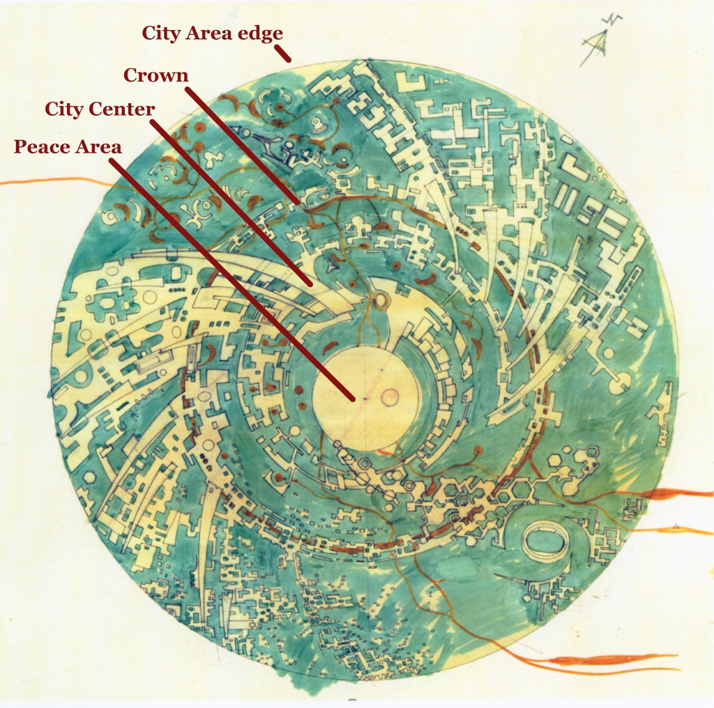
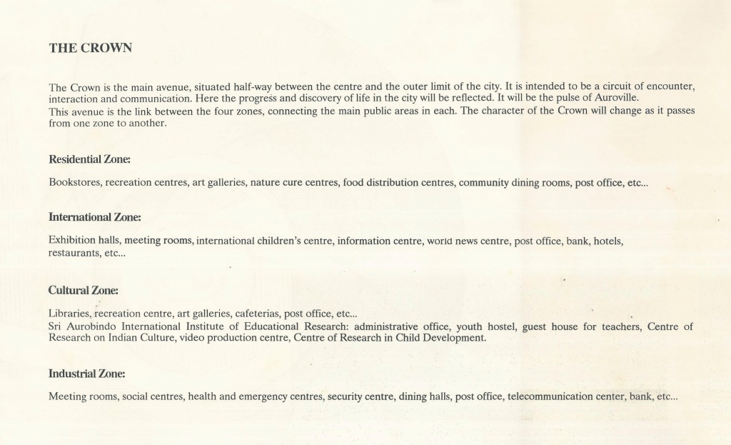
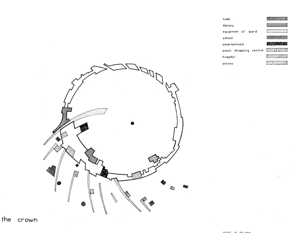
The Crown is a ring around the Center of Auroville, consisting of a circular road and the row of buildings along the inner edge of this road. The Crown lies half-way between the Center of Auroville (which is the Banyan tree next to the Matrimandir) and the edge of the City Area of Auroville. It is envisioned as the backbone of the non-motorized circulation/mobility network of the township, with radial roads and paths curving out from it to the edge of the City Area. It connects the four zones of the township. The Crown road will cater predominantly to slow-moving non-motorized and e-vehicular transport, and emission-free scale-appropriate public transport. Larger vehicles will be allowed only for emergencies and special purposes. The infrastructure backbone of the township will also run underground along this circular road.
The Crown buildings along the inner edge of the road will house the main services and facilities of the four zones of the city: restaurants and canteens, shops and stores, theaters, performance halls, galleries, open and semi-open gathering spaces etc. A separate pathway/street will wind its way through these buildings, connecting the entire ring via a pedestrian-only thoroughfare.
The Crown will be the hub of activity for the township, both in terms of mobility as well as public life. In a way it will be like a hybrid between the archetypes of the Indian street buzzing with street-life and activity, and the European model of the plaza, with gathering and activity spaces interspersed along the Crown.
The area encompassed by the Crown is known as the City Center, which includes at its heart the Peace Area of the Matrimandir, its Gardens and the upcoming Lake. Between the Lake and the Crown, the City Center consists of the inner areas of the four zones of the township. These will also be accessed from the Crown.
Origins of the Crown
When and from where did the idea of the Crown originate? In a way, the Crown’s origins predate the Galaxy Plan itself. When The Mother took up the task to develop Auroville in early-1965, she asked the architect Roger Anger to design her city for her. In March 1966 he presented her with two designs, known as the Rectangular Plan and the Nebula Plan. She selected the latter.
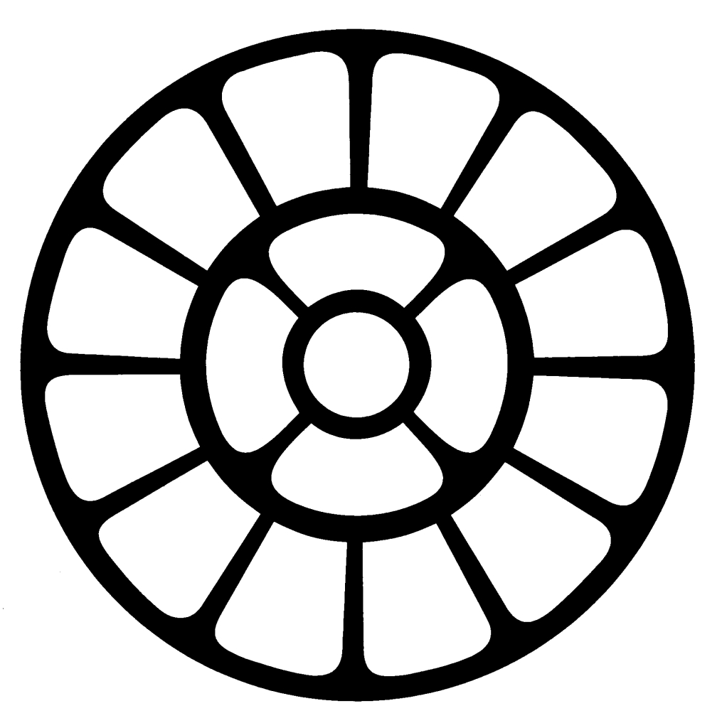
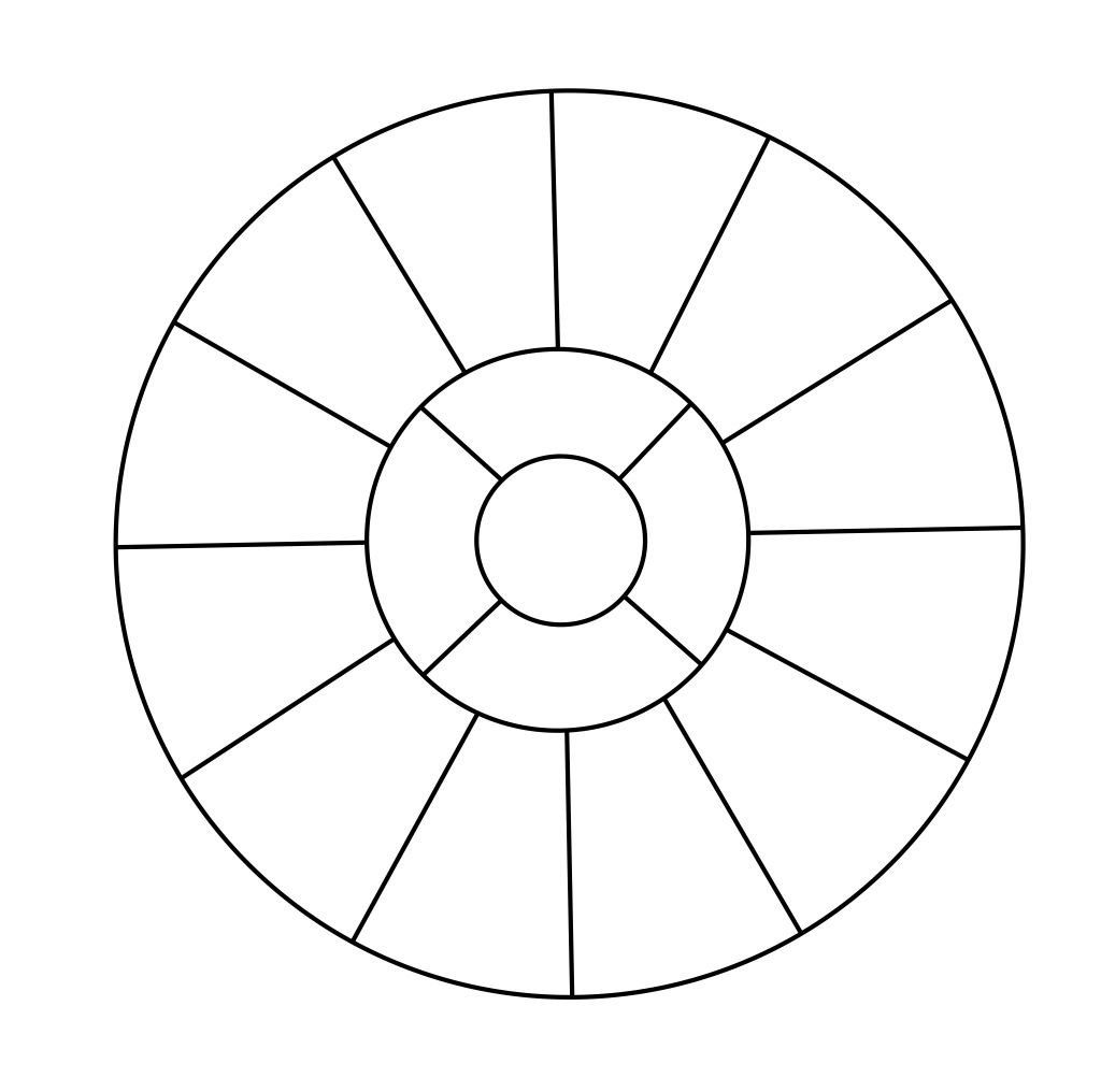
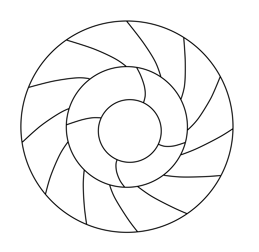
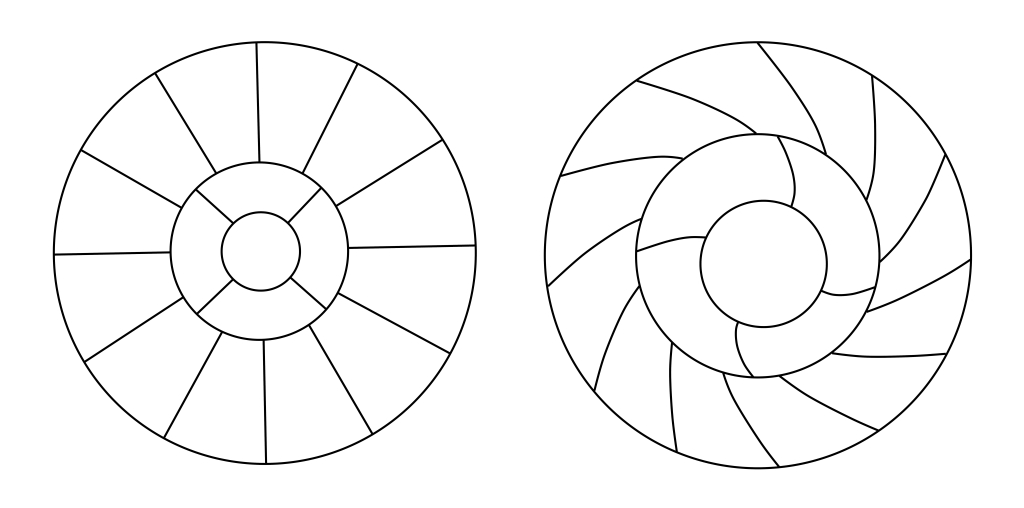
The Nebula Plan was based on The Mother’s symbol. At the Center was always the Matrimandir (initially known as the Shrine of the Mother), and radiating out from the Center were four lines/roads/paths that joined with an encompassing circular road/path. From this circle further radiated out 12 lines/roads to a large outer circle that encompasses the entire town. So we have a Center, a middle circle and an outer circle. There are four lines connecting the Center and the middle circle, and 12 lines between the middle and outer circles. This creates a simplified version of The Mother’s symbol as an urban design.
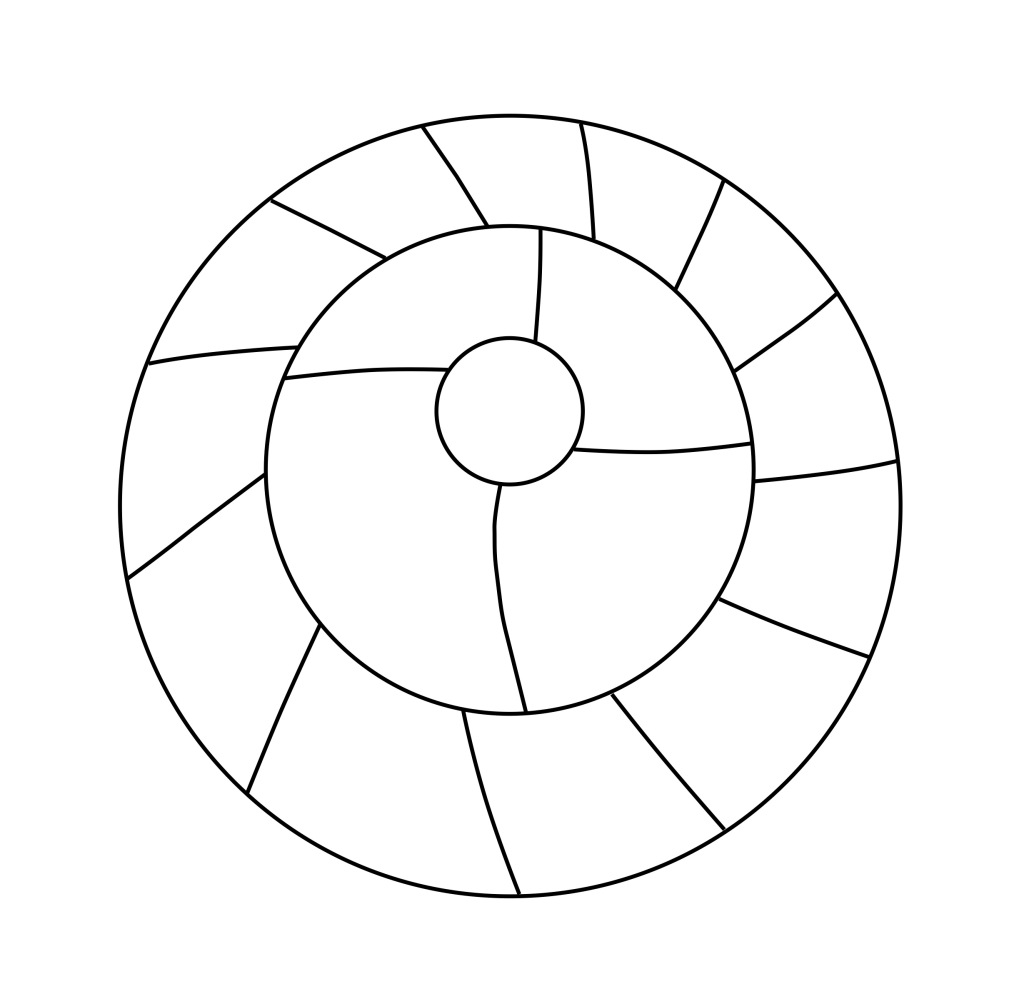
Taking the Nebula Plan as a base, Roger Anger and his team continued to develop their ideas for the township, resulting first in the Macrostructure Plan in early-1967. As Anger has stated, they found the Nebula Plan too static, too reminiscent of “military cities” in its geometry, and worked to give the plan more dynamism. This was done by giving the plan a bit of “spin”. This design looks very different from the Nebula Plan, but the circulation network is familiar. It has the same hierarchy of inner circle, four now curving radiating lines (in the siting diagram), then the middle circle, the twelve radials curving out from that, and finally the outer circle. This network gives shape to the township design, and anchors the Macrostructure Plan as descendant from the Nebula Plan.
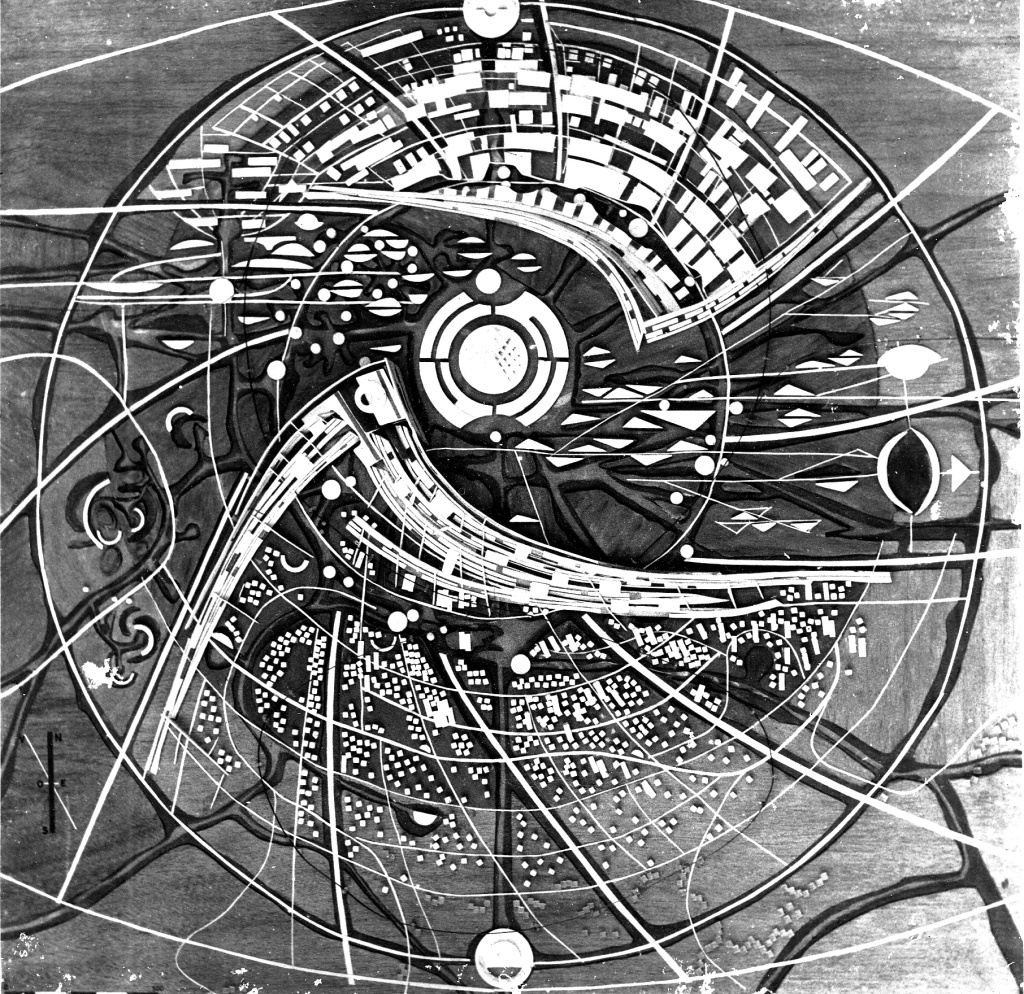
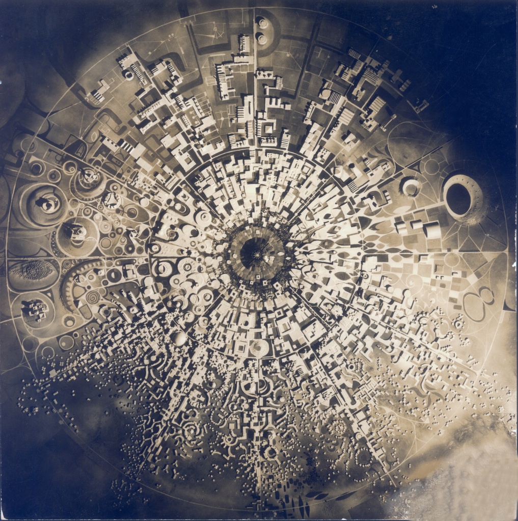
Finding that the two massive building masses of the Macrostructure design were “enclosing the Matrimandir” a bit too much, Anger and his team continued developing the design for the township. In January 1968, just a few weeks before the inauguration ceremony of Auroville, Anger presented the now famous Galaxy Plan to The Mother. She put her signature on it as a mark of approval, and it was displayed at the inauguration ceremony. From then on, the Galaxy Plan became the design that the township is to be based upon. Further modifications have all been within the overall design of the Galaxy.
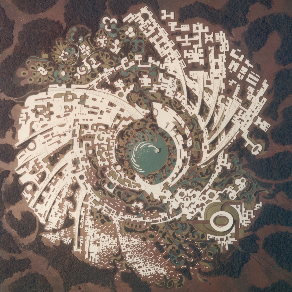
Models made of the Galaxy Plan in the first few years of its existence do not show any road network at all. This is because the models are massing models, showing the general massing and layout of buildings. Even though photographs of these models are what have made the Galaxy Plan so iconic, and in many cases have compelled people from all over the world to come here and dedicate their lives to Auroville, these models do not have the detailing to show things like road networks. However, as soon as Anger and his team started to develop the road network for the Galaxy, it became obvious that the Galaxy’s circulation network is descendant from the Nebula and Macrostructure Plans.
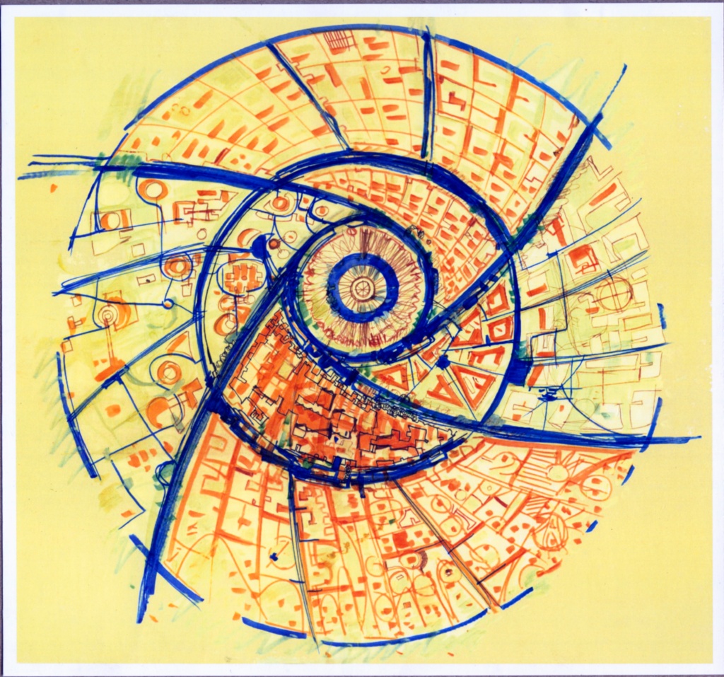
Seeing this progression of the circulation network of the Nebula, Macrostructure and Galaxy Plans, it becomes clear that the Galaxy Plan’s circulation network is based on the Mother’s Symbol, with a dynamic “spin” to it!
From “Middle Circle” to “Crown”
Right from the beginning of the discussions between The Mother and Roger Anger about Auroville’s planning and design, it was established that Auroville was not to be a township with regular fast-moving traffic. In 1965, The Mother responded to a question regarding the kind of transportation that was acceptable within Auroville by writing “Small sized electrically powered vehicles, capable of transporting about 200kg at a speed of 15km/h”. This set the type of traffic envisaged for Auroville.
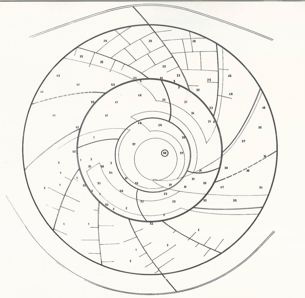
The Nebula and Macrostructure designs were never detailed out, so we do not know what Anger had planned for the “middle circle” in their circulation networks. However for the Galaxy, right from the time the first studies were published in 1969, the Crown was envisaged as “the main ‘Street’ of Auroville”, where the main facilities, amenities and services of the township were to be located.
(published in 1969 in French and 1971 in English)
Despite all this planning (and more over the decades!), not much of the Galaxy Plan exists on the ground today. However the idea of the Crown as the heart of social activity in the township, and as a part of The Mother’s symbol embedded in Auroville, persists till today, which is why it is being taken up as the first major project in the manifestation of the township. Once Auroville has its material and social heart, to compliment the spiritual heart that is the Matrimandir, the rest of the City will follow.
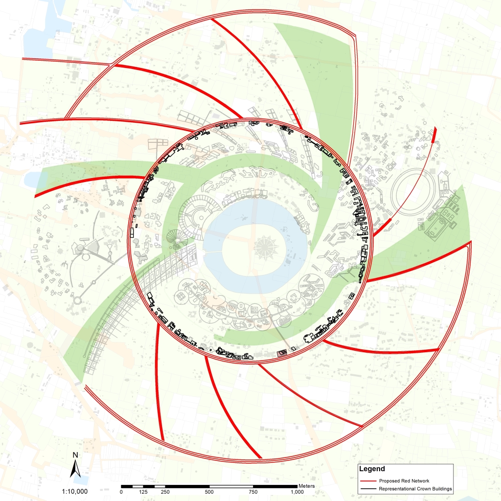
(this map is part of an ongoing design process and will change)
Final Observation
Not only does The Mother’s symbol shape Auroville’s Crown and circulation network, it also shapes the entire township. Auroville is circular in shape because it is modeled after The Mother’s symbol. All other shapes for the township were immediately rejected. Auroville and its Galaxy Plan are a dynamic representation of The Mother’s symbol.
With inputs from ATDC (Auroville Town Development Council) and others

2 responses to “Origin of the Galaxy Plan’s Crown and Circulation Network”
Thank you for this note. Clear and informative.
LikeLike
[…] Galaxy Plan for Auroville was ready just a few weeks before the 28th February 1968 inauguration ceremony. The iconic model of the Galaxy was shown to and […]
LikeLike